Generating PDF document
Please, wait a moment

Too much time loading?
Reload the page and try again.
Please, wait a moment
Too much time loading?
Reload the page and try again.


Description
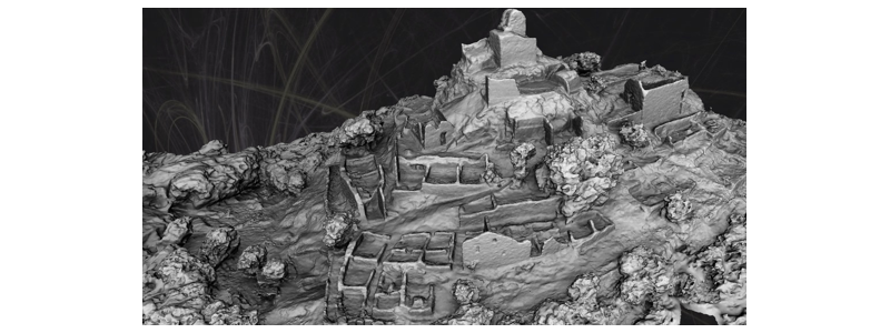
The objective of the 3DCIS project is the design and assessment of rendering technologies, comprehension and transmission of information for the distribution and visualization of three-dimensional contents. These contents are understood as point clouds or three-dimensional meshes) through the web that serve as a data carrier for a geographic information system (GIS) for archeology and topography.Other information
Number of researchers:
6
Development status:
In research and development phase
Intellectual Property Rights:
Susceptible Propiedad Intelectual
Differentiation in the market:
Novedad/calidad
Applicability of technology:
Yes
Companies and markets:
This work is oriented towards obtaining an ad-hoc solution for the integration of three-dimensional information in the field work of professionals in archeology and topography. However, the specific solutions detailed in this work can be extrapolated to other AEC environments (Architecture, Engineering, Construction).
Advantages:
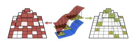
The modules developed in the 3DCIS project meet the following key features: 1. Performance. By choosing a technology where the 3D models that are generated follow a storage and transmission philosophy or streaming based on multi-resolution models, a plug-in free 3D web viewer is obtained with a high performance in the display rate and quality of the models. There is no quality loss, no sampling of the models is necessary, although a pre-processing phase is necessary. 2. Low-cost and open platforms. Project based on open technologies at the software and hardware levels. 3. On-demand software. Several modules under NodeJS and Python have been developed to process point clouds, as well as for the server part in charge of the access (restricted or open) to each one of the 3D models. Each software has been custom made for potential users thanks to the experience of the companies Geobit S.L., Ageo 3D Techy Delta Ingeniería; as well as the experience in the topography area of Cartodesia and its consulting work. 4. Extensible. The 3DCIS architecture has been designed in a modular and extensible way so that any software component, especially oriented towards the advanced visualization module, can be replaced by another one of similar features with a minimum integration effort. 5. Additional features. The solution implemented includes client/server communication software not initially included in the proposal, but necessary within the final architecture that has been developed.3D, rendering, three-dimensional content, point cloud, three-dimensional mesh, GIS, open source.
Additional Information:
Project worthy of the second prize in the 2015-2016 edition of the Concurso Desafío Universidad Empresa (Business University Challenge Competition), organized by the University and Higher Education Foundation of Castilla y León (FUESCYL), the Regional Government of Castilla y León and the Santander Universities Division.
UNESCO Code:
1203 - Computer Sciences (see 3304)
Other members:
Arturo González Estribano
Belén Palop del Río
See more
Margarita Gonzalo Tasis
Francisco Javier Delgado del Hoyo
Rubén Martínez García
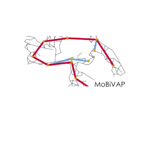
CommonGo is an Android system app that consists of an automatism that allows to determine, in a simple and transparent way to a user, which users use similar routes. This can offer the possibility of sharing routes and taking advantage of what this e... Read more >
VALORIZATION OF BIOMASS BIOFUELS DISCARDED FROM THE LIGNOCELLULOSIC WASTE BIOMASS PRE-TREATMENT TECHNOLOGIES, ENZYMATIC HYDROLYSIS AND BIOCONVERSION OF SUGARS INTO BIOFUELS. - Main researcher: Silvia Bolado Rodríguez - PhD students: Rodolfo Travai... Read more >
IDElab group is developing major projects in collaboration with other GIS (Geographic Information Systems) actors, especially regarding standard and interoperable systems. With the aim of contributing to the technical development of Spatial Data... Read more >
Analysis of blood oxygen saturation and heart frequency for sleep apnoea-hypopnoea syndrome (SAHS) diagnosis. Polysomnography is the main source of information for sleep study. Automatic analysis of cardio-respiratory night signs is very useful for d... Read more >